

Friends from long ago and far away.
Surprises And Paths
Here is a precise what3words address, made of 3 random words. Every 10ft square in the world has its own unique what3words address.
///flattening.rift.recover
https://w3w.co/flattening.rift.recover
43.171855, -76.946558
43°10'18.6780"N, 76°56'47.6088"W
43°10.3113'N, 76°56.79348'W
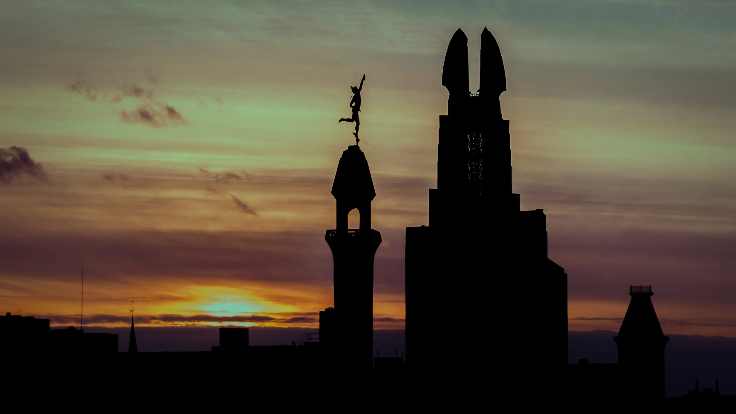
September Fire
Refracciones Vespertinas


https://w3w.co/contest.caged.disbanded
///contest.caged.disbanded
43.553134, -76.213039
This what3words address refers to a 3 metre square location. Tap the link or enter the 3 words into the free what3words app to find it.
Points Of Reflection
Back To Basics
Life has been crazy. There have been too many commitments, too many projects, and too many distractions and responsibilities. My time spent finding peace through my photography-triggered travel has been severely curtailed. It’s time to reprioritize my time and get back to the basics that fuel my soul.
Racing Away
https://w3w.co/flags.leaner.pollution
///flags.leaner.pollution
43.236403, -76.130088
This what3words address refers to a 3 metre square location. Tap the link or enter the 3 words into the free what3words app to find it.
Riding To Lowville For Fuel
The weather was exceptional and the Star Stratoliner Deluxe had half of a tank of fuel. I put a camera in the saddlebags and headed Northeast. 75 miles later I was in Lowville refueling the bike for the ride home.
When traveling through this part of the Tug Hill area, I often stop at this spot at the intersection of Route 177 and Porter Road. There are several similar photographs on WalkaboutChronicles.com from some of those previous visits. It is a beautiful spot and an interesting convergence of high-tech windmills and traditional farmland. If you look closely, you can see an Amish buggy headed toward me from the far end of the road.
It won’t be long before rides like this must be taken in the car and photographs featuring Fall and golden hour colors will be replaced with Winter snow and gray skies.
https://w3w.co/forum.gatherings.newsprint
///forum.gatherings.newsprint
43.799038, -75.607119
This what3words address refers to a 3 metre square location. Tap the link or enter the 3 words into the free what3words app to find it.
Moments Of Manifestation
Opposites Attract
The Rouses Point Bridge, also known as the Korean War Veterans Memorial Bridge, connecting Rouses Point, NY and Alburg, VT, has always fascinated me. Often traveling East to West at the end of a long day experiencing points of interest in Vermont, I find myself in the small parking area attached to the bridge around sunset. For more than a decade, that spot has been the source of all my previously posted images of this unique bridge as it offers great views of the bridge-sunset combination, as well as the bridge’s curved construction. Links to these images appear below.
Finding other interesting spots where the bridge can be photographed is complicated. There aren’t many good vantage points unless a boat is involved.
Enter the drone.
A small road on the New York State side of the bridge leading to the edge of the water is the location of the original bridge. It made an excellent launching spot for the drone. From this location, at 258.6 feet of altitude, I was able to capture this image (and many others), with a brand new perspective.
You can read more about this interesting bridge on Wikipedia.
Other images of this bridge:
Launch site of the drone is here:
https://w3w.co/drastically.activism.requested
///drastically.activism.requested
44.999636, -73.3539